
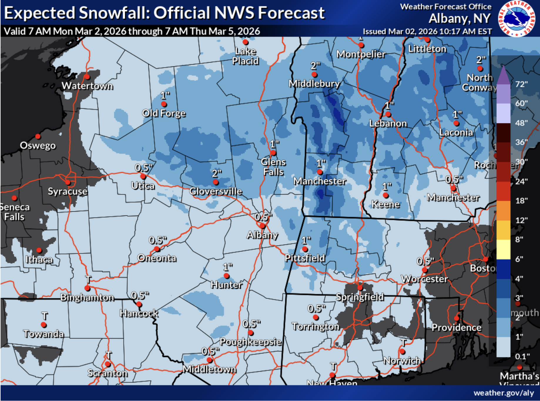
Warming temps to follow slippery Tuesday
Forecasters have “moderate confidence for temperatures to trend warmer than normal for the end of the week into next weekend, especially in valley areas, which will likely ripen and partially melt the existing snow pack.”
But before warming up, a system moving through the region will bring slippery travel to the Hudson Valley on Tuesday, with school closings or early dismissals possible. Due to the cold temperatures currently in place, precipitation on Tuesday morning is expected to start as wet snow before mixing with rain during the afternoon. “The combination of wet snow changing to rain and/or a wintry mix has increased concerns for slippery travel conditions Tuesday afternoon including the evening commute,” according to forecasters at the National Weather Service in Albany. A coating of snow to 2-inches may be possible north of I-84. Some freezing rain may linger in the high elevations early Wednesday morning.
The warm up begins mid-week, as latest probabilities show at least 75-percent chance for temperatures to reach or exceed 45 degrees nearly regionwide both Saturday and Sunday, with temperatures expected to hit 60-degrees by 1pm on Monday in Poughkeepsie.


Support Hudson Valley news + events
ADVERTISEMENT: