Winter Storm Watch in effect for Saturday into Sunday with 8-12" of snow predicted
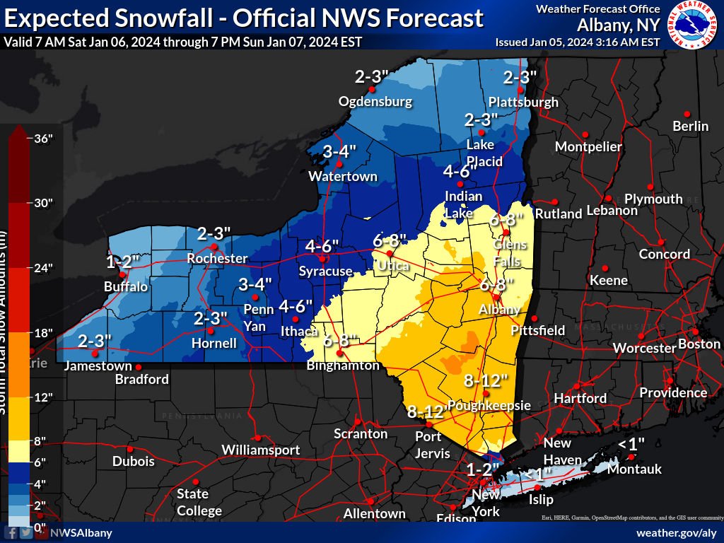
“It won’t be the biggest storm we’ve ever seen, but it will be a decent dump,” according to meteorologist Ben Noll.
The first snowstorm of the season is expected to blanket the Hudson Valley from Saturday evening into Sunday morning with some areas potentially seeing over 12-inches of wet snow.
Here is the latest forecast:
A Winter Storm Watch is in effect for the entire Hudson Valley region from Saturday evening through Sunday morning
Timing: Snow begins to fall after sunset on Saturday evening, between 5-8pm, from south to north. The snow will taper to flurries by Sunday afternoon, between 10am-4pm. The heaviest precipitation is expected between 6am and 4pm on Sunday.
Accumulations: 6-inches or more, with up to a foot or more probable in the Eastern Catskills, mid-Hudson Valley and western New England. Snowfall rates may reach an inch per hour on Saturday night.
Impacts: Winds will gust beween 15-35mph. Snow will have a wetter consistency, according to Noll, making a good snowman, but it may be strenuous to shovel. Roads will quickly become snow-covered and slippery. Conditions are expected to improve toward midday on Sunday.
Advertisement:
Instead of flooding this page with ads, leave us a tip or shop our local makers if you liked this information.





















Add an event to the HVNY calendar at hvny.info/share-your-event